What notes in 17th century book reveal about a transatlantic voyage
ToggleThe handwritten notes in Samuel Sturmy's Mariner's Magazine tell us much and provoke more questions about a long forgotten 17th century voyage, writes Dr Ciarán Mac an Bhaird, Associate Professor in the Department of Mathematics and Statistics.
The history and culture of Ireland, Europe and the wider world are full of tales of migration. When investigating these stories, we often look for signs about where our ancestors travelled from or to.
Perhaps the last place you would expect to find such evidence is hidden within the handwritten calculations and notes on the margins of an old maths book. At school, we are told to not write in our books, imaging how such scribbles are worthless and would blemish the book, making it harder to use or to sell on.
But such notes are exactly what researchers hope to find when looking at old books and archives. These annotations can transform books into priceless treasures which provide clues to help uncover long forgotten human stories.
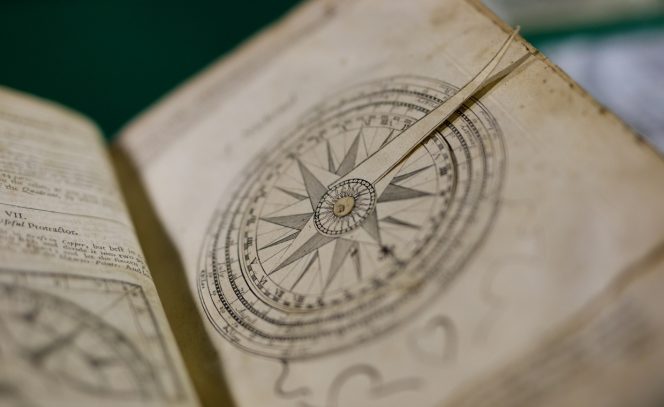
One remarkable example can be found in the Russell Library at Maynooth University in the shape of a rare first edition of The Mariner's Magazine, published in 1669. It was a very successful ‘how to’ mathematical book related to all practical aspects of navigation, including guidelines for calculating a ship’s location when out of sight of land. Sailors needed all the practical help they could get as we had not yet figured out how to accurately calculate longitude (east-west position) at sea. Shipwrecks and disappearances were commonplace, costing lots of lives and money.
 |
 |
| Dr Ciarán Mac a Bhaird at his recent book launch | The Mariner's Magazine |
The book also included details on custom charges, fireworks, fortifications, gunnery, instrument-making, land surveying and sundials. Its author, Samuel Sturmy (1633-1669), was an experienced seaman based in Bristol who had previously taken charge of transatlantic voyages to Virginia and the West Indies.
Prior to this research, The Mariner's Magazine was not widely known within the scholarly community, but the Maynooth Sturmy was commonly on display during public or school tours of the Russell Library, especially during Maths Week and Science Week. Visually, it is a beautiful book, including remarkable foldouts, tables, diagrams, charts and a number of marvellous volvelles (moveable dials).
But perhaps the most remarkable feature of the Maynooth Sturmy is the quantity and variety of annotation throughout the book, which suggests that it was frequently used. Written by multiple people, the annotations include calculations, dates, inscriptions, quotes and signatures. The notes suggest that the Maynooth Sturmy had a long working life, with 'John Diles/1682' found near the back cover, and the signature ‘Thomas Thornton’, along with ‘1763’ on the title page.
One set of calculations caught the attention of Dr Boris Jardine from the University of Cambridge. Sturmy had provided instructions on how to determine latitude (north-south position) and there were latitude calculations of around 37 degrees across several pages. From the data used, Jardine determined that the calculations started on March 2nd and ended on May 25th (12 weeks) in one of the years 1672, 1676, 1680, 1684, 1688 or 1692.
One approach to ocean travel at the time was to leave port (Dublin has latitude around 53 degrees north), and sail mainly within sight of land towards the approximate latitude of your destination. Once you reached that latitude, say 37 degrees, you then followed it across the sea, making repeated calculations to check your north-south position. When you came in sight of land again, you followed known landmarks to travel to your destination.
It seems the book was used as a ledger of observations on quite a long voyage, but where was this ship sailing to? One possibility is Jamestown, Virginia. It was the focal point for British colonies in North America in the 17th century, and its latitude is 37.2 degrees north.
We are further helped by a list of 13 names found amongst annotation near the front of the Maynooth Sturmy: Richard Page, David Magison, Francis Robson, Emma Henton, John Thomas, John Varnum, Jarvas Plumlley, John Diles, Ann Barnes, Mary Barnes, William Daye, John Pike(?), William Johnson. When studying source materials from around 1700 about British colonies along the east coast of North America, Jardine found the names David Magison and John Varnum, the more unusual names on the list.
The Maynooth Sturmy provides significant evidence for at least one specific but long forgotten transatlantic voyage in the late 17th century. However, we are still searching for further details. Can we establish the purpose of this journey, the exact year that it took place, and where the ship sailed from?
Given that transatlantic immigration from Ireland was already a feature of the 17th century, did the ship stop in Ireland as part of its transatlantic route? Where exactly in North America did the passengers disembark, what were their stories and are there people alive today who can trace their ancestry to these passengers? On what other journeys was this book used and how did it end up in the Russell Library?

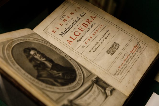
A Seaworthy Book? Samuel Sturmy's Mariner’s Magazine (1669) from Conception to Reception by Dr Boris Jardine is featured in Mathematical Book Histories: Printing, Provenances, and Practices of Reading, edited by MU's Dr Ciarán Mac an Bhaird and Dr Philip Beeley of Oxford University (photographed above at the launch of the book in the Russell Library on November 22, 2024).
 |
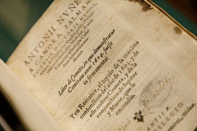 |
Two of the books featured in Mathematical Book Histories
This article originally appeared on RTÉ Brainstorm
